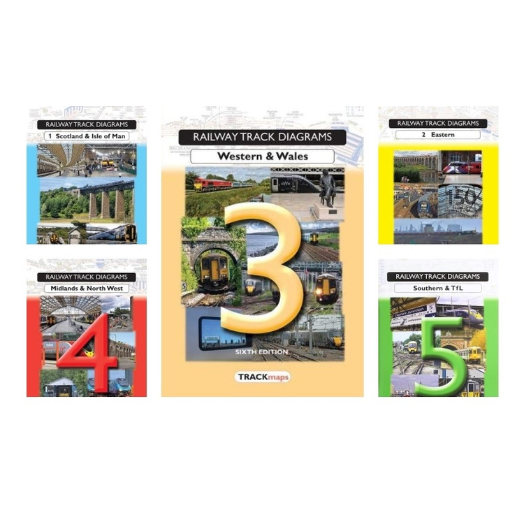
Railway Track Diagrams provide a ready reference for the rail enthusiast and a de facto standard work for the rail industry. Their whole purpose is to record the modern railway in the fullest possible detail for the benefit of the widest range of users. The maps try to show every running line, connection and cross-over on the main lines and in sidings and depots. All passenger and freight routes are shown for the national network, for the Heritage and private lines related to or previously part of it and for other public service railways.
All major infrastructures such as stations, signal boxes, junctions and tunnels appear with their name and railway mileages; most level crossings are also included together with information describing their type. Specific industry information, such as Engineers Line References and Line of Route codes, is given together with some guidance to link today's lines back to the original pre-grouping owners. A comprehensive index covers the named locations on the maps and separate listings are included for ELRs and LORs.
Book 1 – Scotland & Isle of Man covers the network north of the Border (generally as Network Rail's Scotland Route), the railways of the Isle of Man and various Heritage lines. It also includes the SPT Subway in Glasgow and Trams in Edinburgh. Now in 7th edition (the first having been published in 1988), the maps are up to date as at the end of December 2021.
The contents include:
- An Index Map showing the routes covered
- A detailed Key
- A comprehensive list of Abbreviations
- 28 pages of schematic maps in full colour showing the rail routes at track level detail
- An Index of Gaelic and Manx station names
- A listing of Engineers Line References and Line of Route Codes
Book 2 - Eastern covers the network on the eastern side of Britain from London northwards to the Scottish Border. It includes the areas generally as Network Rail's Eastern Region (excluding the MML and Notts/Derby/Leics areas appearing in Book 4) together with public service light rail Metro in Newcastle and SuperTram in Sheffield plus a number of Heritage and leisure lines.
The contents include:
- An Index Map showing the routes covered
- A detailed Key
- A comprehensive list of Abbreviations
- 51 pages of schematic maps in full colour showing the rail routes at track level detail
- A full Index of locations with over 4,000 entries
- A paginated listing of Engineers Line References and Line of Route codes
Book 3 – Western & Wales covers the network from London Paddington into South Wales and the West Country plus the lines in Central and North Wales previously in Book 4. For the first time, it also includes the Crossrail Central Core through London. A number of Heritage and narrow gaugelines also appear. Please note: It no longer includes connecting lines into other regions such as the Chiltern lines to Banbury and the Southern lines to Yeovil that appeared in previous editions.
The contents include:
- An Index Map showing the routes covered
- A detailed Key
- A comprehensive list of Abbreviations
- 36 pages of schematic maps in full colour showing the rail routes at track level detail
- A full Index of locations with over 3,200 entries
- A listing of Engineers Line References
- A listing of Line of Route codes
Book 4 - This book covers the West Coast Main Line from London to the Scottish border and other lines forming the LNW and East Midlands Routes of Network Rail. It includes the tram systems in Birmingham, Manchester and Nottingham together with a number of Heritage lines. It also includes the Chiltern lines (transferred from Book 3) but excludes the North Wales and Cambrian lines (which now appear in Book 3).
The contents include:
- An Index Map showing the routes covered
- A detailed Key
- A comprehensive list of Abbreviations
- 52 schematic maps in full colour showing the rail routes at track level detail
- A full Index of locations with over 3,700 entries
- A listing of Engineers Line References
- A listing of Line of Route codes
Book 5 - Southern & TfL covers the area of Network Rail's three South East Routes, the Overground, Underground, Docklands Light Railway, London Trams and a number of Heritage and leisure lines. This edition includes the Channel Tunnel Rail Link and Eurotunnel in their entirety from St Pancras to Calais plus Crossrail. Now in 4th edition (the first having been published in 1994).
The contents include:
- An Index Map showing the routes covered
- A detailed Key
- A comprehensive list of Abbreviations
- 57 pages of schematic maps in full colour showing the rail routes at track level detail
- A comprehensive Index of locations with over 3,000 entries
- A listing of Engineers Line References appearing in the book
- A listing of Line of Route codes


